
New light on ancient land
Following recent investigations by Time Team, the Roman fort of Branodunum is revealing its secrets for the first time in centuries
On the edge of Brancaster, where the land begins its descent towards the marshes, a subtle rise interrupts the landscape. At first glance it appears entirely natural, but a closer look reveals a faint geometry etched into the earth. Beneath these quiet contours lies Branodunum, a Roman fort that has rested here for nearly 2,000 years and is now cared for by the National Trust. Its story has long remained hidden, preserved not in towering ruins but within the soil itself. Now, thanks to investigations led by archaeologists from the popular television series Time Team, that story is finally beginning to emerge.
One of the Saxon Shore forts built to defend Britain’s eastern coastline, Branodunum first captured national attention in 2012 when Time Team arrived to investigate a striking outline visible in aerial photographs. What they uncovered astonished even seasoned archaeologists. The geophysical survey gathered such an immense volume of data that the computers processing it couldn’t cope. Excavation trenches revealed substantial granaries, barrack blocks and what appeared to be a bathhouse, alongside hundreds of enthralling artefacts.
Exceptionally well preserved, Branodunum offered a rare opportunity to explore a Roman military site that had remained largely untouched since its abandonment. Yet many questions lingered. Several features could not be fully explained, and the civilian settlement that had grown alongside the fort was only partly understood.
“What we found went far beyond our expectations,” recalls Time Team archaeologist Helen Geake. “We left with the sense that we’d only scratched the surface, uncovering the opening chapter of a story we knew we would one day need to return to.”

That next chapter began more than a decade later. In September 2025, armed with technology far more advanced than anything available during the original investigation, Time Team returned with an ambitious goal: to create a complete picture of the fort and its surrounding settlement without disturbing the earth. Ground-penetrating radar swept across more than four hectares, recording data every six centimetres in an incredibly detailed survey. Magnetometry mapped the landscape beyond the ramparts, while a drone flew a precise grid overhead, capturing thousands of images to create a high-resolution 3D model of the site.
For the first time, archaeologists could see almost the entire fort below the surface. At its centre, the principia (the headquarters building) emerged with remarkable clarity, its rooms, corridors and floor surfaces sharply defined. Beneath these structures lay traces of earlier activity, hinting at a more complex history than previously suspected.
Magnetometry revealed a sprawling civilian settlement (vicus) stretching far beyond the areas investigated in 2012. Roads, workshops and domestic buildings appeared across the landscape, indicating that Branodunum’s civilian community may have been considerably larger than experts had initially believed.
National Trust archaeologist Angus Wainwright vividly recalls the moment the first images appeared. “I couldn’t believe my eyes at the results we were gathering; the detail was extraordinary,” he says. “It fires you up, and that is what archaeology is about: unravelling the past and firing imaginations.”

Although the team now possessed a detailed map of the site, its features raised as many questions as they answered. Several buildings did not conform to the layout expected of a Saxon Shore fort. The vicus appeared to have expanded in unexpected directions, while evidence of earlier phases beneath the fort pointed to a more complicated sequence of construction and occupation. The only way to resolve these uncertainties was to excavate.
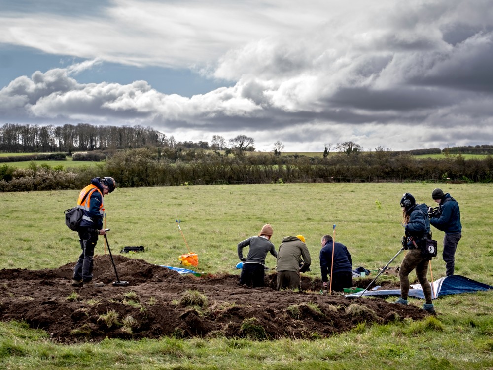
In March 2026, Time Team returned once again to carry out a three-day dig. For a brief period, the tranquil coastal field was transformed into a bustling archaeological research centre. A white dome rose to house the temporary studio, while a long marquee served as the finds tent, where volunteers carefully cleaned pottery, bone and tile with toothbrushes. Six trenches were opened in response to the geophysical surveys, four within the fort and two in the vicus.
One trench cut through the main gatehouse, exposing the foundations of the fort wall and the threshold once crossed by Roman soldiers. Another investigated a curious structure nicknamed the ‘wonky building’, which may have served a religious function. Elsewhere within the fort, archaeologists uncovered the remains of a substantial residential building, its layout still clearly visible beneath the soil.
The vicus offered a more intimate glimpse of daily life. Among the finds were an iron knife, tweezers and small brushes that may have been used for cosmetic purposes. Oyster shells appeared throughout the deposits, silent evidence of meals eaten nearly two millennia ago.

“The dig was really successful. From Roman buildings and footings of fort walls to the fascinating finds within the trenches, we uncovered more than expected,” Angus reflects. “It will be very exciting to piece together all this new evidence as we build a more detailed picture of the fort and settlement.”
Far from providing definitive answers, the recent excavations have prompted a new phase of research. Specialists are currently analysing the artefacts recovered during the dig, while the extensive geophysical data gathered is helping archaeologists reconstruct the fort in unprecedented detail. With large areas of the site still unexplored and fresh questions arising with every investigation, the rediscovery of Branodunum is only just beginning.